1 Sep 2019
Good Morning! Well, first order of business is a cup of coffee, sit with me? :-). Then, as our brains awake the second thing is to start figuring out where to go today… so many choices!

Ok, here is a logistics problem with the route planning… The PC/web browser version of Google maps allows clicking on a route to drop a vector point that can then be used to ‘drag’ the route. Very handy (and a fast way) to lay out a course that defeats the computers penchant to force efficiency. Problem is when you save the route the vectors are lost, so it’s not possible to send those directions to your phone for navigation. The alternative is to drop intermediate way-points along the route. The problem then shifts to the fact that as you reach each way-point you have to acknowledge it before the map will display the next leg. No big deal you say. Ahhh but it is because, even though my gloves are suppose to work with a touchscreen, they don’t always :-/. Plus even if they were perfect, does anyone really think that trying to fumble with a phone on a motorcycle while riding along at a fun speed is a good idea?

After all that it’s decided, let’s head towards Asheville. We are not sure how far we can get, so we laid down half a dozen points to keep us ‘on the good roads’ til at least lunch time.
Off we go. The first 80 miles or so was rolling hills, then we crisscrossed the Blue Ridge Parkway several times as we moved higher into the mountains. We deliberately didn’t take the Parkway because we want to come back at some point and run the length of it. Also, I have a sense that it might be rather frustrating to be on such a nice road with all the cars piloted by ‘Sunday Drivers’.

Even though we were avoiding it, there were a few miles our path ran on the Parkway, so no choice there. Right as we got on the parkway a sign for the first overlook came and went. Might as well stop if we see another right? So, we then started to look; ah, there it is. Pulled in, rolled over by the sidewalk and parked. As I approached the low wall next to the side walk and looked out the scene was pretty beyond words. It was rather surprising how high up we were, the plain so far below, and the clouds floating over the valley made it picture perfect.
I couldn’t help but notice an older pickup truck with a cap on the bed parked next to us, with a gentleman walking his hound dog back to it. Iconic right? We exchanged pleasantries. Beautiful view. Nice day. Perfect weather. Then, as he was putting the dog in the back he looks away and says to no one in particular ‘I should have never come’. Pause. Glance back. Since we were just talking I am still paying attention so he continues. ‘This was her favorite place, she’s been gone for a year now’. Oh my goodness, atypical casual conversation with a stranger. What to say? ‘Well, this is a good way to honor her memory.’ He nodded, got in the truck and drove away.
I have been reminded before that we are often in the midst of hurting people, but this one was particularity poignant because of how it presented and also because we had just learned that a friend had died in her sleep also leaving her husband alone. Give out a smile or kind word to a random person you meet, perhaps you will be easing their burden in ways you’ll never even imagine.
Well, on we go… Ah, what’s this???
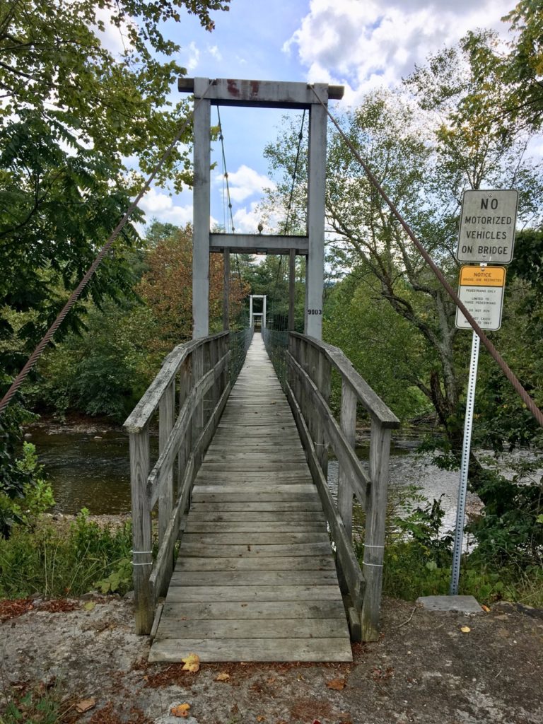
A foot bridge with an official looking sign, gotta go back and check that out right? :-). I really struggled (for a minute) about crossing. There were No Trespassing signs plastered everywhere, but… the bridge really looked government like. I mean really, what person would build a bridge like this and stick a ‘no vehicles’ sign up next to it? Gotta be public right?

Ok, enough wrangling, let’s go :-).

How cool is this? Pretty river, granddad taking the boy fishing. A little hard to walk on though, have to admit. The up down part wasn’t so bad, but side to side? That’s rough, I found myself bouncing off the cables :-). And I wasn’t even goofing off (or drinking L0L).

After stopping in the rudimentary parking lot, crossing the bridge, looking at the road and its name think I figured out what’s going on here (hey never claimed to be quick :-). The only river crossing to get to the home on the other side is here at Slippery Ford. If the river is high, you’re out of luck, so you walk across the bridge… Interesting. Love to see comments below from someone who has first had experience with this sort of thing.
What will we find next…
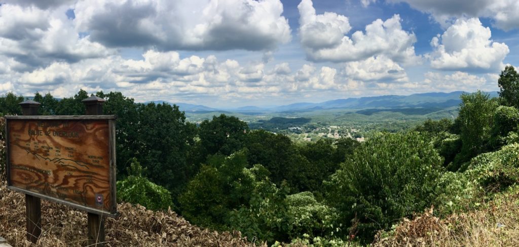
Another pretty overlook but it has quite a different flavor compared to the one we visited on the Parkway. This is one was ‘old school’. To start with it’s on an old state highway that, interesting enough, is called Cumberland Gap Road. I had no idea where Cumberland Gap was despite name recognition from some history lesson how many years ago. So I looked – its a long way from here… perhaps back in the day this was the road that took you there? The stop itself is a pull off, little more than an extended shoulder, bounded with a rough-cut stone wall.

Oh, and the road up: marvelous! In fact, it was so good when we turned around to come back to the overlook we drove past, went all the way to the bottom, then back up again :-).
Two Minutes of Twisties
The most interesting part wasn’t the view, and probably wasn’t even the ride, but what happened next. As we pulled in from the far lane a car coming down the mountain pulled in too. He was a little timid, meeting on this narrow pull-out, so we rather gingerly passed by each other as we came to a stop. I got off, his wife got out. Same story: a little small talk as we look out over the plain below hemmed in by mountains. Beautiful view, gorgeous day. Where are you from, where are you going. Then a transition as a story pops out. Then another, and another. Oh my goodness, this gal is full of them!
I started off thinking ‘remember these, and jot them down later’. Not a chance. At one point I asked if she considered herself a story teller, and was she writing these down? Yes, I suppose and no, not really. Oh, please do! Her grandfather was a country doctor near by, making rounds taking care of mountain folk in this rather remote area. One of his sons also went to medical school, but couldn’t afford to finish, so the local communities pitched in and paid for him to finish school so they could continue to have access to medical care. There were stories of romance and heart break, and loads of ‘normal life’ vignettes. I could sit and listen for hours, but… time to move along. What a sweet stop.
On we go…
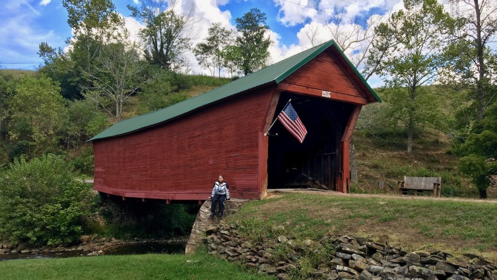
… to a covered bridge.
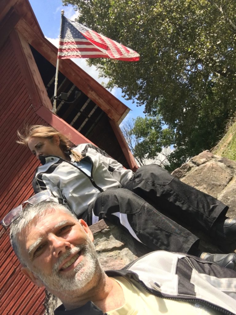
Rather interesting, of the four bridges built in this area three remain to this day, and of the three remaining this was the nicest.

In case you haven’t noticed… This place exudes magical photographical pixie dust – all the pictures we took here came out so very nice. (well, I didn’t post them all so I suppose you’ll have to trust me on that one, but they really did ;-).
Next stop…
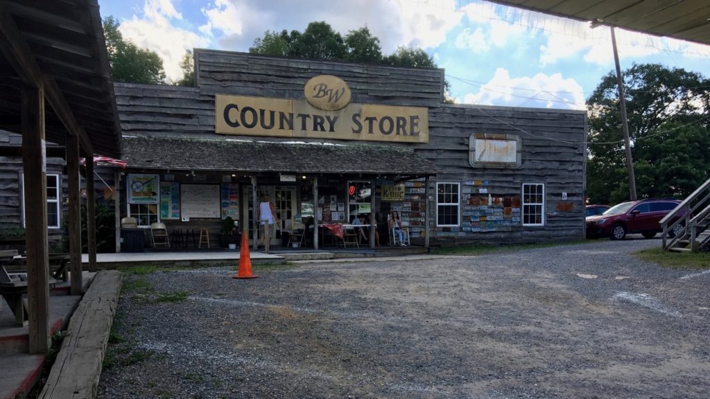
… the Big Walker Country Store and fire watch tower. Fun place, lots of bikes visiting. I did find out later that ‘The Back of the Dragon”, a knock off of “The Tail of the Dragon” is just a few miles west of here – Next time.

The store owns the old fire watch tower and charges a few bucks to allow you to climb up – hey I’m sure it pays for fresh paint and to replace rotted steps right? :-).
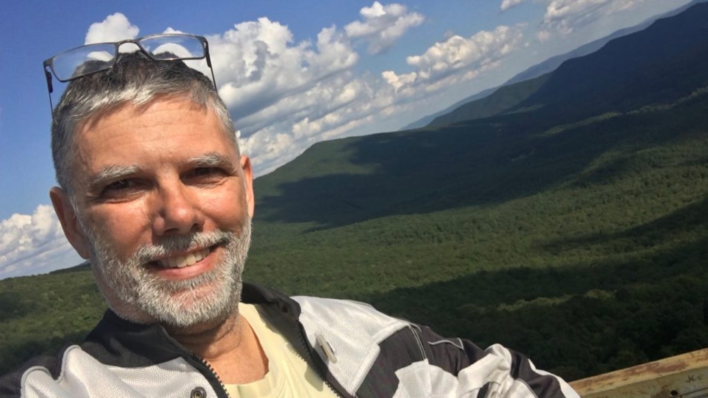
The steps were rather short, but there were a lot of them! I think around 200 or so. Every time I thought ‘that must be the last flight’ I would turn the corner and see more! Finally got there.

Well worth it. Such a pretty day with the sun and clouds.
Well, are we there yet? Nope! What’s this? A bonafide mansion.
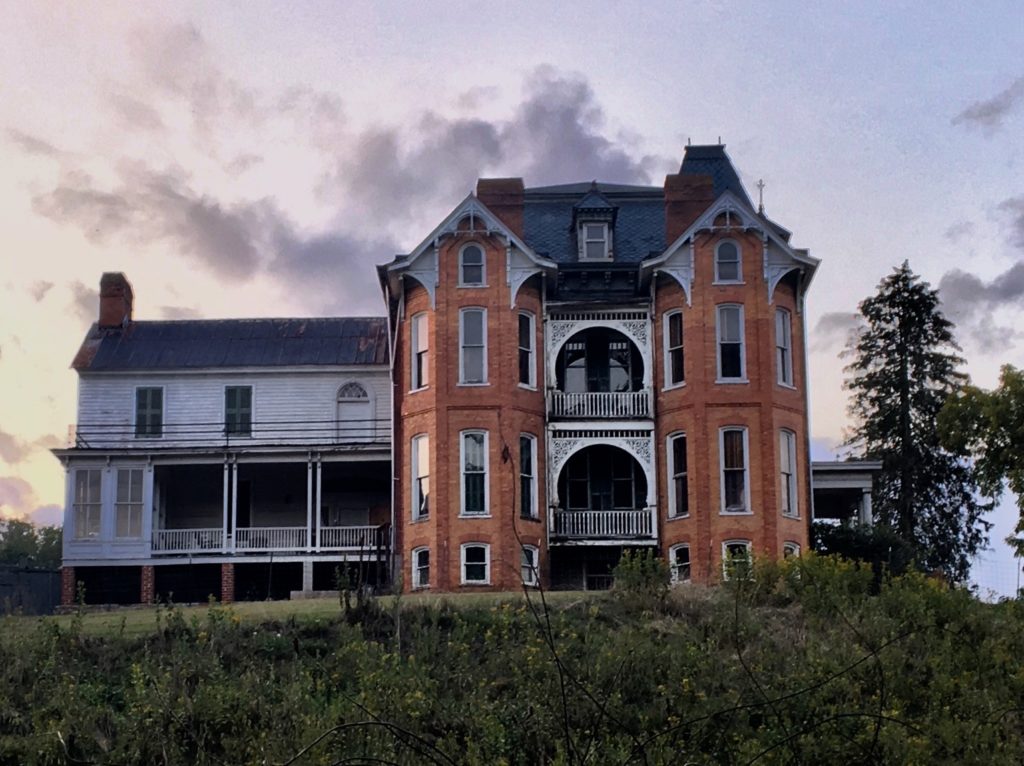
We came in the ‘back way’ over an increasingly narrow road that eventually ended up gravel. Then just as it switched back to pavement and bent around a right hand corner we came to this house.

It was set up for various commercial events from concerts to Halloween.
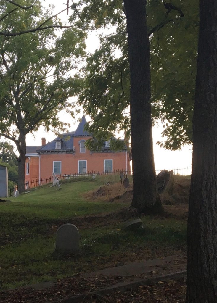
But… based on some reading we did later there does appear to be some paranormal activity associated with the place. Night is falling, we’ll just pass right along and leave that for someone else to discover.
Well, that’s a day… we covered a lot of ground, saw lots of sights, and thoroughly enjoyed the whole thing. Look around on the map below, and as usual there are additional photos and descriptions there for your enjoyment.

The covered bridge is so familiar. Was that in Thurmont?? Joe’s dad lived just a few yards from there. His wife still lives there.
No Clare, this one is not in Thurmont – but the one I posted on FB is….
https://www.facebook.com/photo.php?fbid=10156269267501682&set=p.10156269267501682&type=3
What a beautiful ride! The climb up the fire watch tower reminded me of my oldest brother’s summer job one year while working his way through college. He spent a summer at a mountain top lookout on the northern Washington/Idaho border called Stone Johny Lookout (spelling probably wrong) watching for forest fires. Probably around 1957-60 time frame. Only the foundation posts remain at that place in the far northwest. But it is still alive in Google. Geo-cachiers (sp?) go there now and then. Looking forward to more installments.
Thanks for the comment Al, so glad you enjoyed it. I (should) be a little quicker on the next one ;-).
Well, seems like folks in CA might want to revise the practice of watching for fire? Been tough out that way. I suppose they watched in certain seasons? Oh, did your brother ever have occasion to alert for a fire?
The correct spelling was Stone Johnny Lookout and there are a couple of pictures of that shorter tower on Google. I’m not sure that lookout towers would be of that much value with the fast-flare up fires of the dry areas of southern California. The people on a tower would be in danger as fast as they could report it. I think that the detection technology has improved to the point where people don’t need to sit on mountain tops any longer. Fortunately my brother had an uneventful summer on his lookout…Except for occasional encounters with wildlife when he descended the tower to use the ‘facilities’.
I always enjoy reading your writings. So descriptive, I think I am right there along side you.
I’m glad you enjoy it Rich… and, no reason you couldn’t be right there along side https://youtu.be/DqBt0C_BG4o 😉